Introduction
In order to estimate the direct tangible damage caused by rainwater flooding in urban areas, the economic impact on property and vehicles has been taken into consideration, as these are the most affected assets, according to the data provided by the Insurance Compensation Consortium (CCS - Consorcio de Compensación de Seguros), which is the public body that covers losses generated by extreme climate phenomena, among others.
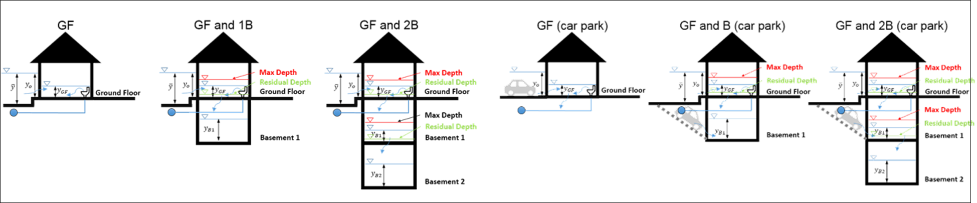
The assessment of property damage was carried out by following a methodology based on the use of damage curves, which measure damage according to the depth of the flooding. The first step was to transfer the depth of water in surrounding streets to the interiors of the properties (sourced from a hydrodynamic model), based on watertightness coefficients developed for the fourteen uses of land (types of property) in Barcelona, and whether there was a step at the entrance to the property. Secondly, the flooding damage caused to the properties was assessed, using the specific damage curves based on flooding depths inside the buildings, developed for the fourteen types of property. Furthermore, a maximum depth was proposed where there were lower floors, so that when it reached that specified level, there was only water transfer to levels below that. Various types of property were considered: without basement, with basement and with two basement floors. Configurations were also considered with or without car parks, because where there is a car park, the water enters not only from the floor above, but also directly from the street, an aspect which is also taken into consideration through the watertightness coefficient curves. The model is implemented through the use of GIS tools, in order to establish a water depth inside the buildings and calculate the corresponding damage.
With regard to assessing damage to vehicles, an innovative methodology has been used, which is also based on the concept of damage curves. The methodology attempts to reduce any uncertainty due to the mobility of the vehicles, proposing a heterogeneous vehicle occupation for various areas of the city, based on information provided by high-resolution aerial photography. The first step is to adapt the damage curves for flooding developed by USACE (U.S. Army Corps of Engineers, 2009) for five types of vehicle, in the case of Barcelona. These curves were turned into a single damage curve weighted according to the percentage of each type of vehicle found in Barcelona, and also taking into consideration their depreciation, according to statistical information for the type of vehicle and average age.
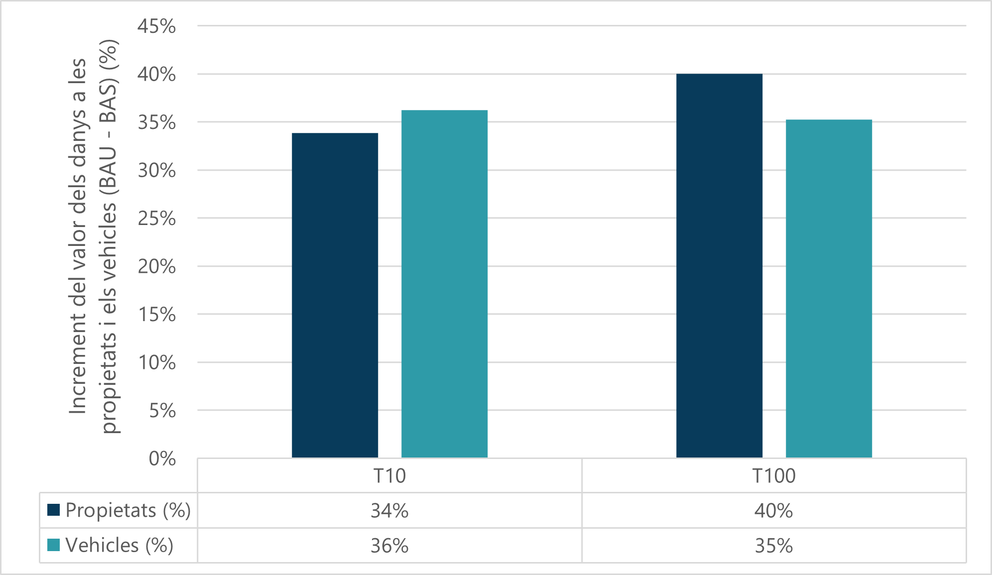
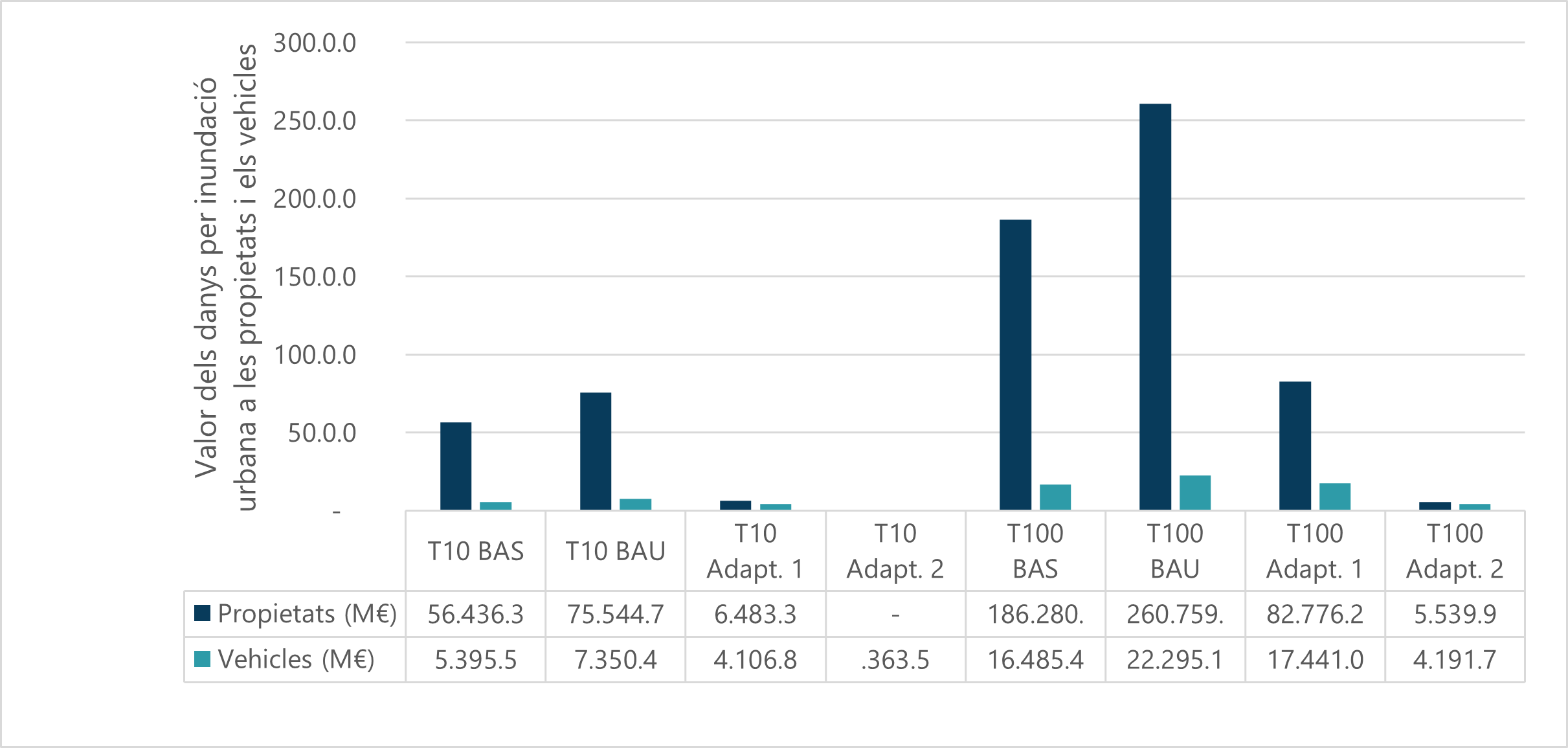
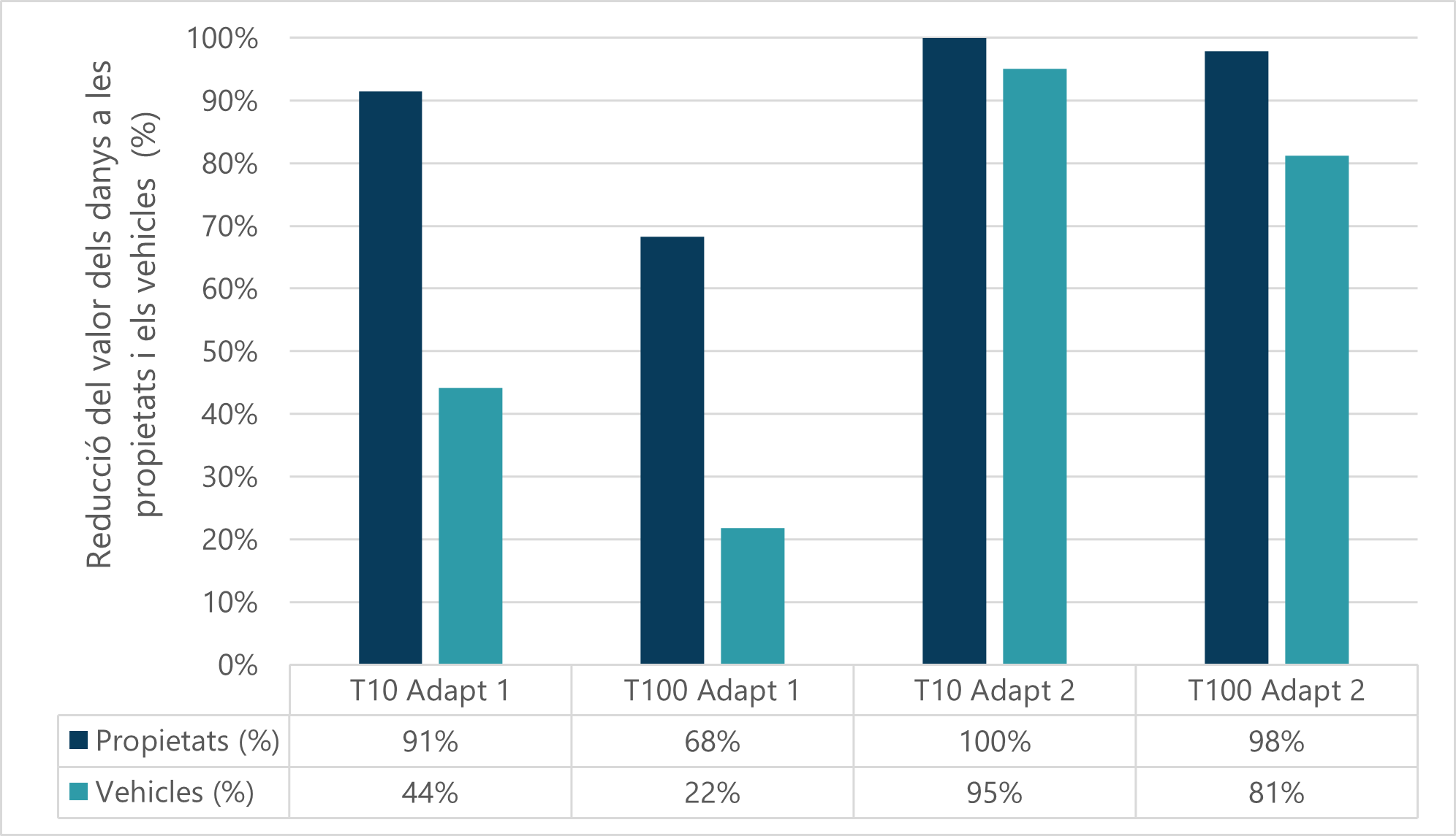
Maps have been obtained for direct tangible damage caused by rainwater floods in urban areas, for both property and vehicles, for the T1, T10 and T100 return periods, and current, future and Adaptation 1 and 2 scenarios , with the calculated value of damage aggregated for each city neighbourhood. In the case of the T1 return period, the damage value is null, and it is therefore not represented in the maps. The damage maps for vehicles are not represented either, as the differences are not very representative in terms of the affected neighbourhoods, and the value of the damage caused to vehicles by flooding are in the order of ten times lower than the damage caused to property.