Introduction
Due to its geographic location, Barcelona is prone to significantly high heat accumulation in urban surfaces. This situation is aggravated by rises in temperatures: firstly, this intensifies the urban island heat effect and, secondly, the increase of more prolonged heatwave episodes. As seen in the studies carried out within the framework of the Barcelona City Council Climate Plan, the heat island effect causes temperature variation between the city centre and its surroundings of up to 3ºC, which can go up to 7ºC or 8ºC during high intensity episodes.
Both phenomena have direct effects on resource consumption and on people’s health, especially for vulnerable groups (elderly, babies, people with chronic illnesses and underprivileged people, such as the homeless).
Working from previously-carried out studies within the framework of the Climate Plan, this study aims to identify the areas of the city where a low level of thermal comfort may affect the continuity of everyday life for people living there. This is especially true for the most vulnerable, and can have direct consequences on their health and well-being. Increasingly, heat exposure, according to future projections for Barcelona, is being aggravated by substantial increases in temperatures due to the effects of climate change.

Heat retention
The idea of heat retention applied to the city refers to the extent to which urban surfaces exposed to solar radiation can retain heat. Within the framework of the study, this potential has been calculated by combining three factors:
1) The first, and most important, is solar radiation incidence, which is calculated from a three-dimensional model of the city.
2) Second, the albedo, notably how urban surfaces behave when expose to solar radiation, and the extent o which they absorb or reflect its incidence.
3) The third parameter considered in this analysis vegetation density, urban tree cover and other green areas that filter solar radiation before it reaches the ground and uses it, among other processes, to evaporate water in leaves.
By combining these factors, three levels of vulnerability have been determined, expressed as different levels of heat comfort (medium-low, low, very low). In other words, the sections of urban fabric which, according to the parameters mentioned above, retain most heat, have a lower level of heat comfort and show more vulnerable conditions for the population.
Finally, the difference, or coincidence, should be mentioned that can exist between a higher potential risk of heat accumulation in a surface, due to morphological factors (albedo, vegetation and solar radiation), and a lower socio-economic level, or, indeed, the demographic composition of a neighbourhood. That means that the vulnerability of a population exposed to a lower level of heat comfort due to its built environment´s characteristics may also be aggravated by conditions of a socio-economic nature (level of family income, level of education and employment profile, etc.).
Areas of risk
If we differentiate between the areas of the city according to their features (albedo, vegetation cover and solar radiation), sections of urban fabric stand out with some high heat comfort values (due to their proximity to large city parks, such as Ciutadella and Tres Turons), as well as differences between residential neighbourhoods with a large proportion of vegetation, like Sant Martí de Provençals and Pedralbes and areas with a lower proportion of greenery, like La Dreta de l’Eixample, and industrial areas like El Bon Pastor. Additionally, with a lower heat comfort index, areas are highlighted with less reflective cover, such as Zona Franca and the port, hot infrastructure, like Sants train station or Fira II de Barcelona conference area, and large road infrastructures devoid of vegetation, such as the Litoral and Dalt ring roads.
Where is the most vulnerable population located?
Although heat may represent a risk to the whole population, it must be remembered that certain profiles (for reasons of age or socio-economic level) are more vulnerable than others. In this regard, beyond the vulnerable groups previously-mentioned in the introduction, the most exposed demographic groups in terms of heat impact, regardless of their health conditions, are babies and the elderly.
Setting out the most critical points
With the aim of setting out the most vulnerable areas to heat exposure, the following map crosses territorialised information on heat comfort levels (illustrated in the previous section) with two sets of demographic data:
1) the 2018 census, disaggregated by age groups (0-4, 5-14, 15-34, 36-64, 75 and older) at the scale of residential blocks, to find out where there is higher density of residents, and
2) public facilities, classified by typology and connected to age groups, to identify the areas of the city potentially most used by certain population groups.
The first set of data, the densest areas in terms of residents could be set out, disaggregated by age groups, while the second set was used to identify the areas of the city potentially used more by different population groups, assuming that the areas with the greatest concentration of facilities specifically intended for these groups are also those which receive the highest influx from these groups of people.
The purpose of this exercise is to highlight, on a qualitative level, those areas where a higher exposure to risk overlaps with population density above the city average and higher concentration of facilities intended for the target age group of the study.
However, it should be mentioned that the question ‘Where is the most vulnerable population located?’ may not have just one answer. This is because the population moves depending on the time of day, work and free-time activities carried out. Therefore, we should bear in mind that these maps require large-scale reading and that risks must be contextualised as a whole.
The following map compares population density in different age groups with the areas most exposed to the effect of heat.
By selecting a specific age group on the map, we can observe the overlap between the risk theme analysed and the areas where there is more concentration of that age group.
It is estimated that close to half of the people residing in Barcelona are to be found in the areas with medium-low levels of heat comfort, mostly, low and very low. Also located in these areas are close to half of the facilities where it is calculated that they spend a part of the day. For example, we are talking about approximately 350 educational centres for babies (from 0 to 4 years old), 140 play areas for children (from 0 to 12 years old), 16 active ageing zones and 250 social service centres for elderly people (75 years and older).
The coincidence of each of the three levels of low heat comfort defined by this work, with areas of higher population density and concentration of facilities, generates a gradation of the vulnerability level that can be seen set out in six grades, as below:
| 1P. Medium-low heat comfort linked to population density | 1PE. Medium-low heat comfort linked to population density and public facilities |
| 2P. Low heat comfort linked to population density | 2PE. Low heat comfort linked to population density and public facilities |
| 3P. Very low heat comfort linked to population density | 3PE. Very low heat comfort linked to population density and public facilities |
The following map shows those areas of the city where we see more people exposed to the effect of heat by age group
By selecting a specific age group on the map, we can observe the most critical points, depending on the overlap between the risk theme analysed and the areas where there is a greater concentration of differen age groups
The gradual coincidence of more resident people (population density above the city average) with more areas of concentration of facilities and areas with a low level of heat comfort reveals parts of the city that allow us to identify, as a guide, the most critical risk points for each age group.
The critical points that we can highlight for babies (0-4 years) are found together with blocks in the neighbourhoods of Ciutat Meridiana, Les Roquetes and Verdum at their limits with the Dalt ring road. We also find them around Meridiana in the neighbourhoods of La Trinitat Nova and La Torre Llobeta, La Sagrera and Navas. Around Grand Via, blocks also stand out in the neighbourhoods of Provençals del Poblenou, Sant Martí de Provençals, and El Besòs and El Maresme. Of a more isolated nature, we also see blocks that stand out with less heat comfort in the neighbourhoods of Sants, El Guinardó and La Verneda i la Pau.
The territorialisation of the risks for children (5-14 years) is linked to a certain extent to that of babies. This situation can be explained if we take into account that there are facilities that provide services to both age groups. A similar situation can be seen with the critical points for teenagers (15-19 years).
A slightly different reading is seen with young people (20-34 years) and adults (35-74 years), in which the concentration of the respective educational, healthcare and social services facilities correspond to areas with a lower level of heat comfort. However, it may be a good time to remember that the bulk of the economically-active population (16-65 years) is found in these two age groups which suggests that many of these people spend more hours of the day in their places of work than using these facilities, as opposed to other demographics who are more likely to use them throughout the day - such as infants, teenagers and the elderly. In this case, surely, population is more relevant than the concentration of facilities.
As for the elderly, the blocks identified having less heat comfort are found in the neighbourhood of La Sagrera and the Mig ring road (around Lesseps Square, the neighbourhoods of Salut, El Camp d’en Grassot and Gràcia Nova, and La Vila de Gràcia). To a lesser extent, we see blocks in the neighbourhoods of Sagrada Familia, El Congrés and Els Indians, La Prosperitat, El Baix Guinardó and Navas.
Finally, it is necessary to highlight that the other areas with little heat comfort in the city are also the areas in which residents face greater economic challenges. In 2017, the neighbourhoods of Ciutat Meridiana, Les Roquetes, Verdum and La Trinitat Nova recorded a very low disposable family income, and low in the case of the neighbourhoods of La Sagrera and Vilapicina and Torre Llobeta.
Related initiatives
Taking into account the importance of green infrastructure to mitigate heat accumulation, all the measures which seek to increase urban green in the city will be key to reducing the risk of surface temperature rises. For years, Barcelona City Council has been working to increase green surfaces in the city. The 2020 Barcelona Green and Biodiversity Plan sets forth a raft of projects aimed at increasing green infrastructure, improving it with the conservation of urban biodiversity, and a civic life with an intimate nature and which contributes well-being and health.
In 2017, a government measure was presented: ‘Impulse Programme for Urban Green Infrastructure’. Its aim was to solidify the actions to be taken to support the objective of the Barcelona Climate Commitment to incorporate 1.6 square kilometres of greenery by the year 2030. This objective was also included in the Climate Plan (2018) and more recently in the Climate Emergency Declaration (2020).
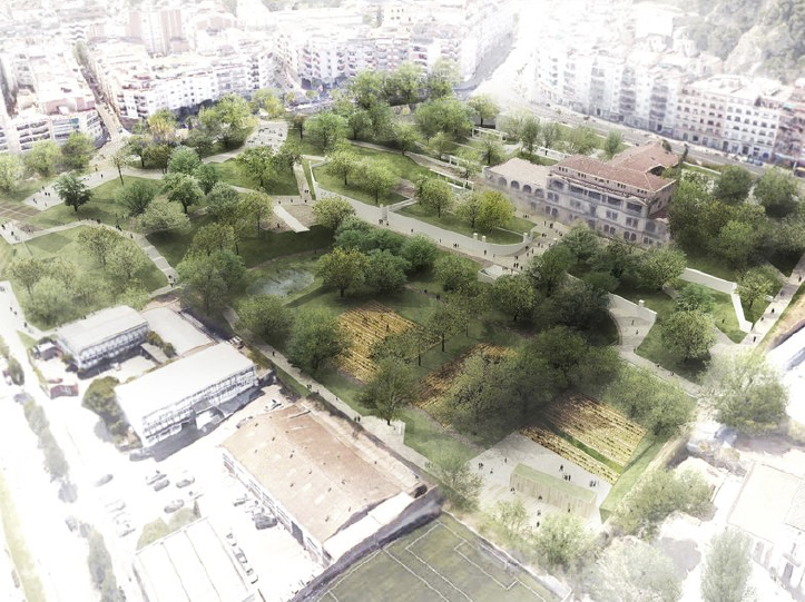
In this regard, amongst the major initiatives undertaken in recent years, of note are the large city projects to increase green infrastructure and also small spaces with potential. Amongst the high-potential initiatives, we have the project ‘Urban Canopy’ (Plaça de les Glòries Catalanes), the gardens of Doctor Pla and Armengol (Mas Ravetllat), the new green axis in Cristóbal de Moura or the transformation of Avinguda Meridiana, as well as the increase in greenery linked to street pacification processes, such as the redevelopment of the super block in the Sant Antoni neighbourhood, which could potentially be further extended to other parts of the city. Amongst the small-scale initiatives, there has been work on developing green roofs, opening up unused spaces under the ‘Buits’ (empty) plan and the installation of vertical gardens on party walls. Also of note is the work on enhancing public spaces in recent years led by neighbourhood plans in Ciutat Meridiana, Les Roquetes and La Trinitat Nova, which relates to land detected as particularly vulnerable by this study.
More recently, the new plans for 22@ and the establishment of green axes in the Eixample district offer a great opportunity for structural transformation integrating green infrastructure and environmental services contributing to the urban context, e.g. climate regulation.
Furthermore, also noteworthy is the strategy which has already been put into action in the city to generate a network of public spaces and climate shelters where people, especially the most vulnerable groups, such as the elderly, can make use of the heat comfort conditions offered during heat waves and, more generally, at times of intense heat.
The Barcelona Resistance Programme is a new opportunity to highlight the efforts to implement structural measures to increase greenery and the socio-environmental services provided to the city. Which is why in the Action Plan for green infrastructure´s states that the focus should be on the naturalisation of urban spaces.